

Tongwynlais is surrounded by beautiful walks so I’m starting a new series to share these routes. Let’s begin with two of the most well known trails through Fforest Fawr.
Fforest Fawr is managed by Natural Resources Wales and they’ve signposted a few walks in the forest. I’ve included the routes at the end of this article.

Sir Henry’s Trail
Difficulty – Moderate
Distance – 2.4 miles | 3.9 km
Time – 2 hours
Elevation gain – 90m
You can start this loop at the Fforest Fawr car park or outside Castell Coch. The trail is easy to follow but has some rocky inclines.
The elevation ranges from 90m to 180m.

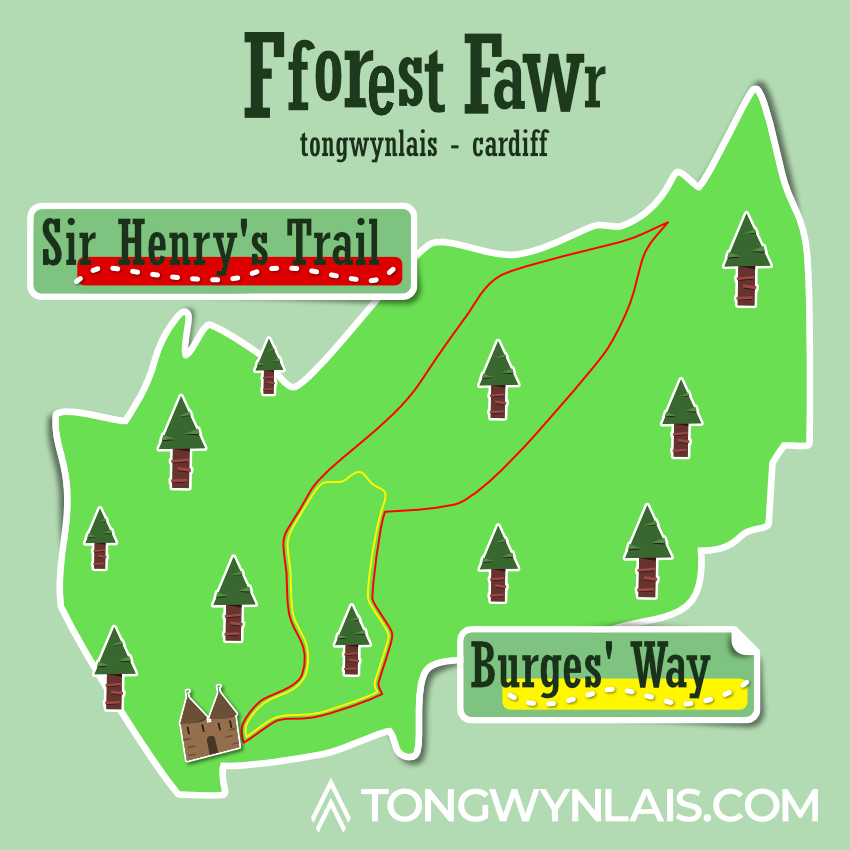

Burges’ Way
Difficulty – Moderate
Distance – 1.1 mile | 1.8 km
Time – 1 hour
Elevation gain – 75m
Set off from Castell Coch and explore the beautiful Fforest Fawr on this short walk.
The trail is easy to follow but has some rocky inclines.

Map
If you can’t wait for part 2, head over to Tongwynlais Walks for some fantastic guides by Martin and Teilo.
Make sure you plan appropriately, wear suitable clothing and take all the necessary equipment to ensure your safety. I can’t guarantee the accuracy of this information and you undertake any activities at your own risk. If you have any questions about access, please contact Natural Resources Wales.